Ancient Egypt, one of the most iconic civilizations in human history, owes much of its enduring legacy to its distinct and captivating geography. Understanding the physical landscape of Egypt—the role of the Nile River, its surrounding deserts, fertile floodplains, and natural resources—offers valuable insight into how this remarkable culture flourished for thousands of years. This article takes you on a journey through ancient Egypt’s geography, illustrating how terrain and environment shaped the development of a civilization that has fascinated the world for millennia.
The Lifeblood of Egypt: The Nile River
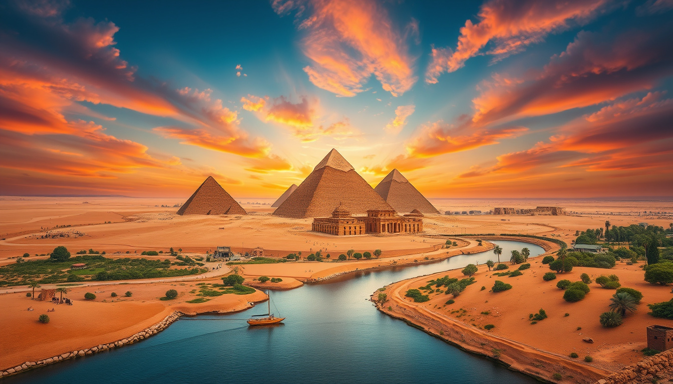
At the heart of ancient Egyptian civilization was the Nile River, an extraordinary natural feature that shaped the land and the people. Flowing northward for approximately 4,135 miles (6,650 kilometers) from the mountainous south to the Mediterranean Sea in the north, the Nile was the main artery upon which all life in Egypt depended.
Upper and Lower Egypt: Geography Defined by the Nile
Ancient Egypt was originally divided into two distinct regions based on the direction of the Nile’s flow:
- Upper Egypt: Located in the southern part of the country, Upper Egypt was characterized by mountainous terrain and narrow valleys along the Nile’s southern stretches.
- Lower Egypt: Situated in the north, Lower Egypt consisted primarily of the Nile Delta—a vast, fertile region where the river split into numerous distributaries before emptying into the Mediterranean Sea.
This division was not merely geographic but also cultural and political, representing the duality that symbolized much of Egyptian civilization.
The Gift of the Nile
Greek historian Herodotus famously hailed Egypt as the "Gift of the Nile." This tribute emphasized the vital importance of the river’s annual flooding, which deposited nutrient-rich silt along its banks. This fertile silt transformed the surrounding land—otherwise desolate desert—into arable farmland, enabling the Egyptians to cultivate crops such as wheat, barley, and flax.
Without these predictable floods, Egypt’s agriculture would have been impossible, and the civilization might never have developed. Consequently, the Nile served multiple essential purposes including:
- Irrigation for crops
- Transportation and trade routes
- Supporting fishing and other sustenance activities
The Natural Borders: Black Land and Red Land
The geography of ancient Egypt was uniquely marked by a stark contrast between two natural terrains known as the Black Land and the Red Land.
The Black Land (Kemet)
The Black Land, or Kemet in the Egyptian language, referred to the fertile, dark soil deposited by the Nile’s annual floods. This strip of arable land stretched on both sides of the river for miles, providing the foundation for Egypt’s agricultural economy and food security.
The Red Land (Deshret)
Surrounding the Black Land on either side were vast expanses of arid desert, called the Red Land. These harsh environments protected Egypt from invasions due to their inhospitable nature. The deserts to the west, part of the immense Sahara, and to the east, known as the Eastern Desert or Red Sea Hills, served as natural barriers that isolated the civilization, allowing it to thrive relatively undisturbed for thousands of years.
Desert Resources and Economic Wealth
Though seemingly barren, the deserts surrounding the Nile Valley offered valuable resources. Mining activities in these regions yielded minerals such as copper, gold, quartzite, and limestone—all essential materials for the construction of tools, tombs, temples, and jewelry.
- Gold: Egypt was renowned for its extraordinary gold reserves, so plentiful that a Hittite ruler once claimed Egypt had as much gold as sand.
- Copper: Mines in the Sinai Peninsula and Eastern Desert supplied this essential metal.
- Mining and Quarrying: The deserts offered stones like quartzite and limestone, crucial for the building of Egypt’s monumental architecture.
These natural resources enabled Egypt to engage in trade with neighboring regions. Importing timber, lapis lazuli, ivory, silver, ebony, and olive oil contributed to an extensive economy that supported both the elite and common populations.
The Nile Delta: Egypt’s Breadbasket
The Nile Delta in Lower Egypt was a fertile and expansive region that played a key role in agriculture and trade. Its network of distributaries provided abundant water supply and fertile soil for multiple crop harvests annually. The delta’s rich productivity enabled the population to grow and cities to develop, while serving as an important commercial hub linking Egypt with the Mediterranean world.
Seasonal Cycles and Agricultural Practices
Egypt’s climate and geography created distinct seasonal cycles that governed agricultural practices:
- Akhet (Flood Season): During this period, floodwaters from the Nile submerged the fields, fertilizing the land with silt.
- Peret (Planting Season): Once floodwaters receded, farmers planted crops in the prepared fields.
- Shemu (Harvest Season): This season marked the gathering of crops, crucial for sustaining the population.
These seasons, deeply tied to the Nile’s rhythms, shaped not only agriculture but cultural and religious life throughout ancient Egyptian history.
Egypt’s Southern Boundary and Western Desert
The southern boundary of ancient Egypt was traditionally marked by the First Cataract located about six hundred miles south of the Mediterranean coast. This natural barrier of rapids and waterfalls defined the extent of Egyptian political influence during the Old Kingdom.
To the west of the Nile lay the vast Sahara Desert, a formidable expanse that provided isolation from neighboring civilizations to the west and south. Within the desert, oases provided refuge, water, and occasional settlements, but the barren expanse predominantly acted as a protective buffer against invasions.
Geographical Influence on Egyptian Civilization
The geography of ancient Egypt had profound influences on the civilization’s stability, culture, and economy:
- Natural Defense: The deserts served as natural fortifications, reducing foreign incursions.
- Agricultural Abundance: The Nile’s predictable flooding ensured food surplus, allowing the development of cities, administration, and monumental architecture.
- Trade Networks: River and sea routes connected Egypt with Africa, the Near East, and the Mediterranean, encouraging cultural exchange and economic prosperity.
Understanding Egypt’s geography deepens our appreciation of how the environment nurtured the growth and longevity of this magnificent civilization.
Frequently Asked Questions (FAQ)
Q1: Why was the Nile River so important to ancient Egypt?
A1: The Nile provided essential water for irrigation, supported agriculture through annual flooding that deposited fertile silt, enabled transportation and trade, and was central to Egyptian religious and cultural life.
Q2: What are the Black Land and the Red Land?
A2: The Black Land (Kemet) refers to the fertile soils along the Nile, whereas the Red Land (Deshret) describes the surrounding deserts that protected Egypt from invasions.
Q3: How did Egypt’s deserts protect the civilization?
A3: The deserts acted as natural barriers that limited incursions from neighboring peoples, allowing Egyptian culture to thrive with less threat of invasion or conflict.
Q4: What role did the Nile Delta play in ancient Egypt’s economy?
A4: The Nile Delta was a fertile agricultural region producing crops that supported the population and served as a critical trade and transportation hub connecting Egypt to the Mediterranean.
Q5: How did Egypt’s geography influence its seasonal calendar?
A5: Egypt’s year was divided into three seasons tied to the Nile’s flood cycle: Akhet (flood), Peret (planting), and Shemu (harvest), which structured agricultural and social activities.
Conclusion
The enchanting landscapes of ancient Egypt—from the life-giving Nile River and fertile floodplains to the protective deserts and mineral-rich hills—were far more than just a backdrop. They were active participants in the creation and sustainability of one of the world’s greatest civilizations. The interplay of natural resources, geography, and climate shaped Egyptian agriculture, defense, economy, and culture, allowing this ancient society to flourish for thousands of years. Exploring Egypt’s geography not only unravels the secrets behind its historical success but also enriches our understanding of how humans can adapt and thrive in challenging environments. Through this journey, the land of the pharaohs continues to captivate our imagination, inviting us to admire the enduring bond between nature and culture.